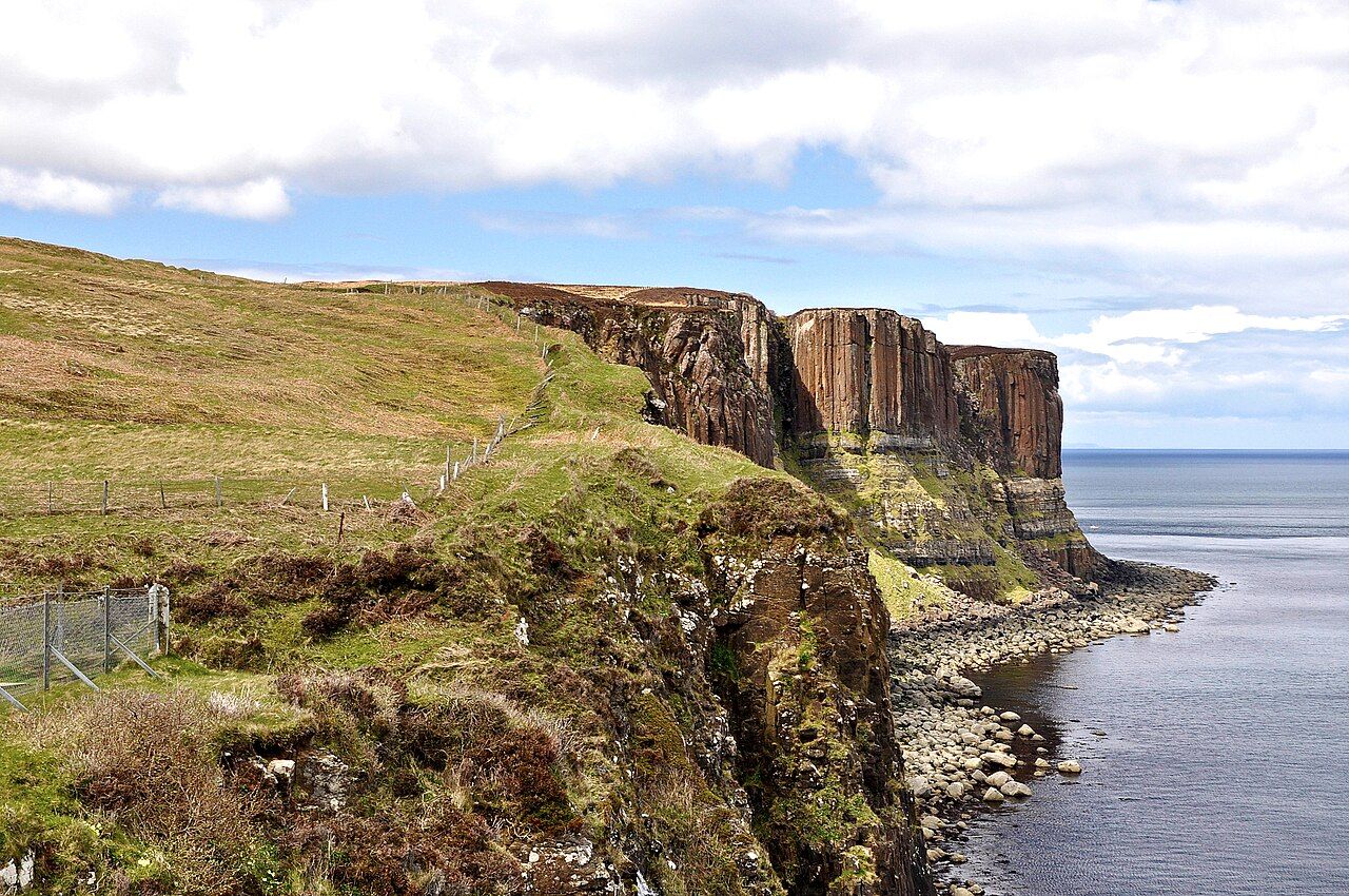
Kilt Rock — photo: Paul Hermans
At Kilt Rock, the cliff and the falling water hold the eye in different ways: one is a pattern in the rock, the other a moving line between Loch Mealt and the sea. From the viewing platform on the cliff top, both belong to the same edge of Trotternish, though they make quite separate impressions.
| Place | Kilt Rock, near Staffin |
|---|---|
| Cliff | About 90 metres high; columns of basalt over sandstone |
| Waterfall | Mealt Falls drops about 55 metres from Loch Mealt into the sea |
| View | A viewing platform stands on the cliff top by the car park |
The name gives the cliff a familiar shape to compare with, and the columns of basalt explain why that comparison holds. They rise above a layer of sandstone, making the rock look pleated; the likeness is not a decoration added to the place, but the way its structure meets the eye.
It is worth giving that pattern a little time. The word “kilt” can make the image arrive before the cliff does, a ready-made idea that is easy to carry too firmly. Here the rock is the thing itself: basalt columns, sandstone beneath, and a face that seems folded into regular lines.
My dog-eared paper map has a habit of making places look flatter than they are. At Kilt Rock, it is an especially poor interpreter of the view, where the height of the cliff matters as much as the stripes across it. The cliffs are about 90 metres high, and that scale changes the way the patterns read.
Mealt Falls gives the eye another direction to follow. It drops about 55 metres from Loch Mealt straight into the sea, beside the cliff, so the water’s descent is not separate from the coastal edge but part of what defines it.
From that platform, I find it useful to look first at the rock, then at the water, rather than trying to take both in as one view. The basalt columns make a repeated pattern, while the fall is a single moving line; the contrast is plain, and does not need dressing up. The sea below completes the route of the water, and the loch above gives its starting point; between them, the height is part of the view.
The cliff and the waterfall are two different ways of looking at the same edge.
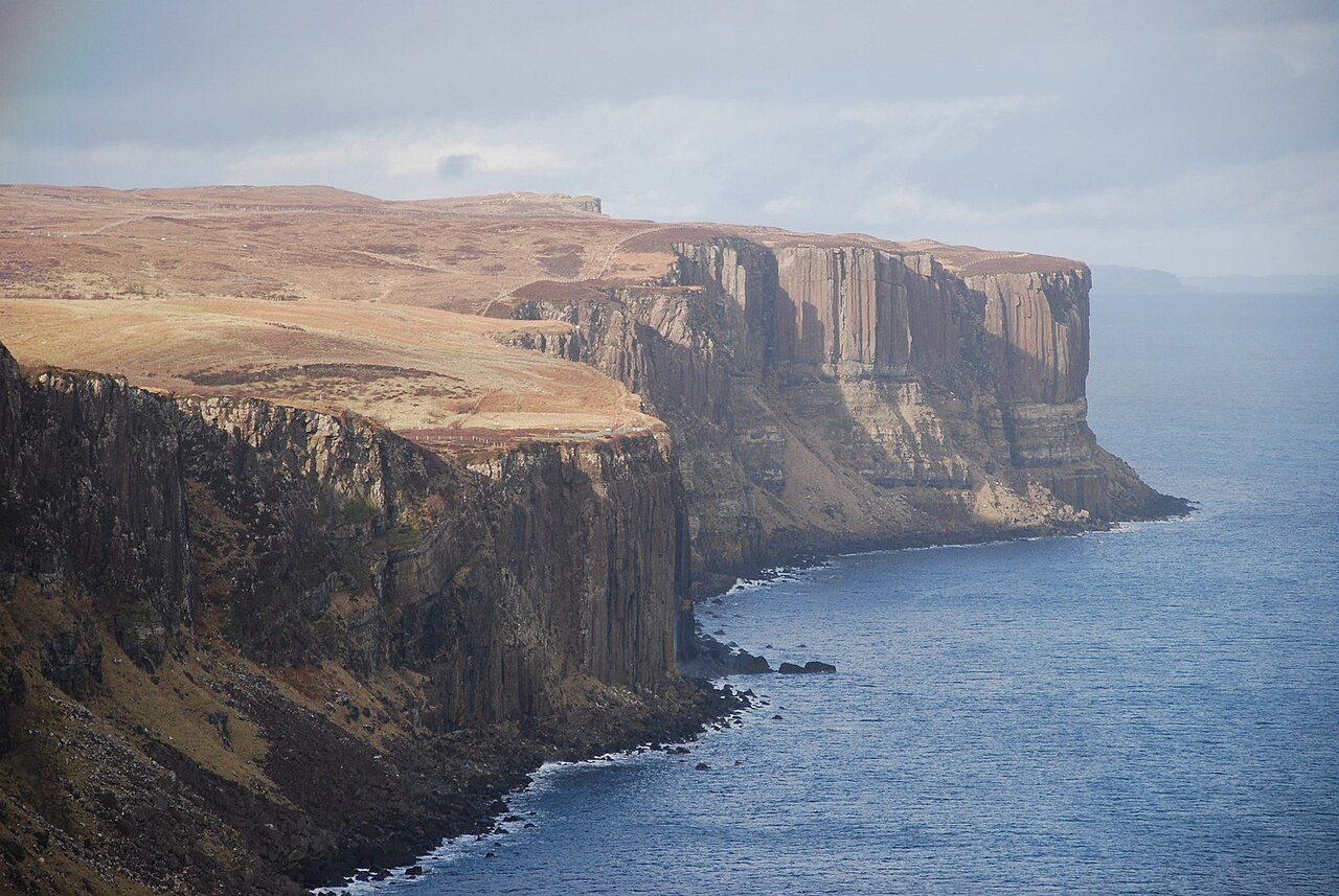
The cliff and the waterfall are two different ways of looking at the same edge.
That is the small distinction I keep coming back to. The basalt holds a fixed pattern; the waterfall keeps falling. One asks for attention to the arrangement of the rock, while the other makes the gap between loch and sea visible in a single drop.
On windy days, the spray from the waterfall blows back up the cliff. It is a detail that changes the direction of the scene without changing its essentials: the water still comes from Loch Mealt, and the sea remains directly below its fall.
The viewing platform stands on the cliff top by the car park, placing the view where the two features can be considered together. It is a practical vantage, but the best way to use it is simply to let the cliff keep its scale and the falls keep their movement.
There is another kind of expectation in a name such as the Fairy Glen, which seems to promise an imagined shape before the eye has settled on a real one. Kilt Rock works more plainly: its resemblance comes from the basalt columns and sandstone, and the water beside them needs no comparison to make its way down.
Dinosaur Footprints at Staffin is worth a look as well.
On my dog-eared paper map, the place can be marked as a point; here, that mark cannot contain the height, the pleats, or the straight fall of water. A map is good at naming, and less good at holding the difference between a cliff and the sight of one.
Kilt Rock is not only the striped face, nor only the waterfall beside it. The two meet at the coast near Staffin, each making the other easier to notice: stone in its layers, water in its descent, and the sea receiving the fall below.
That is enough to bring me back to the platform in thought: a fixed cliff with its pleated columns, Mealt Falls dropping from Loch Mealt, and, on windy days, spray rising back up the face.